The Beginning and the End
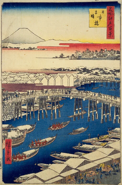
Nihonbashi bridge in clear weather after snowfall by Utagawa Hiroshige, 1856
Kaido trails in Japan form the pre-industrial age transportation network system that connected major cities in the middle ages. These were designed and laid out for predominantly human foot traffic, with provisions for horse-based transport in case of urgent transactions. While conceptually these roads have existed since ancient times, the formal consolidation, demarcation, and outfitting of paths reached its most complete and contemporaneous state by the hands of Tokugawa Shogunate, the advent of Edo Period in the 17th Century. After centuries of civil unrest and feudal strife, this was the age of unparalleled peace, and with it came a surveilled yet abundant flow of people, objects, and information. One of the greatest of these ancient highways is called Tokaido, which means the "Eastern Sea Trail" as it runs along the Pacific Coast, and to this day connects present day Tokyo, Nagoya, and ultimately Kyoto.
“The Tokaido was intensively travelled. It had 53 checkpoints, or stations, to strictly control the journey. Fifty three was no arbitrary number. It specifically invoked the spiritual quest of the boy Sudharna (Zenzai-doji)... whose striving for Enlightenment is recounted in the culminating book of the Garland Sutra (Kegon-kyo), a primary text of Japanese Buddhism… This conceptualization of the highway fitted with Edo’s status in 1603 as a new city, still largely an encampment, mired in war. After walking 500 kilometers from Nihon-bashi, passing 53 shogunal inspectors, a person entered the capital to find Japan’s most venerable seats of learning.”
──Timon Screech, Tokyo Before Tokyo, Reaktion Books, London, 2020. Pp. 70-71
Inspired by Professor Screech’s depiction of Tokaido and the idea of enlightenment, as well as for the more earthly motivation of exercise, I started running or trekking on challenging terrains of the kaido trails a few years ago. The pace of this activity has been accelerated by the unprecedented pandemic, which has allowed me to physically, and historio-vicariously, explore lights and shadows within Japan. After completing the Tokaido in 2020, the list of completed trails now include kaido trails to Mito and Nikko, and I am currently embarking on the Nakasendo trail. Without exception, all trails emanate from Nihonbashi Bridge. As the West has the enigmatic Milliarium Aureum and the proverb, “All roads lead to Rome'', so does Japan have the Nihonbashi Bridge and may I say so, “All roads lead to Edo (Tokyo)”.
Nihonbashi Bridge was the preeminent monument extraordinaire in Tokyo of Edo Period – not only for its temporal and physical beginning of a life-changing journey to then-capital Kyoto – but for its sheer size. So large, the bridge can be considered and indeed functioned as a public thoroughfare, observation deck, informal market, and plaza all at once. Fantastically appropriated by various social classes, political fanfares (daimyo gyoretsu), and commercial activities, it was no mere bridge. It was perhaps the only truly public space ever to have been created in Japan, which are persistently rare to this very day and did not exist under the auspices of temples, shrines, or imperial households. Alas, it was a timber bridge, magnificent yet ephemeral! The seat of most powerful feudal governance chose a timber bridge, susceptible to fires and floods, as a beginning and the end of all paths, embedded with manifold systems of controls, symbols, and functions that refused to be encapsulated in something concrete and perceptible.
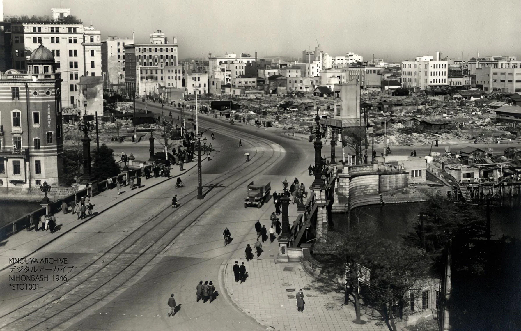
Nihonbashi bridge, 1951
To this day, Nihonbashi Bridge contains the Kilometer Zero of Japan, from which all distances are measured. While these markers are usually monumentalized and publicly accessible elsewhere, the bronze marker here was placed smack dab in the middle of the bridge that has quite a vehicular traffic. Thus, a brave few souls willing to risk their lives may be able to see the marker, but otherwise it is consciously made to be inconspicuous, receding from our apprehension of reality. As with many power structures or signs of control in Japan, this Kilometer Zero marker too is an empty center. Whether out of deference or fear, these markers, no matter how physically manifested, have veiled layers of cultural, political, even spiritual masques. In some cases, we choose to intentionally not see them, glossed over as if protected by some ultra hightech thermo-optic camouflage.
///////////////////////////
Next month, we will continue on this theme of “Reasons to Run the Kaido Trails” onto the actual trails!
English Writing: Kaz Yoneda
Peer Reader: Gregory Serweta
Editor: Hinako Izuhara
Associate: Tatsuri Sonobe
Text Reference
Timon Screech, Tokyo Before Tokyo, Reaktion Books, London, 2020. Pp. 70-71
Photo Credits
1……Clearing Weather after Snow at Nihonbashi (Nihonbashi sessei) from Hiroshige's One Hundred Famous Views of Edo(Meisho Edo Hyakkei), Archived at the National Diet Library Digital Collection(https://dl.ndl.go.jp/info:ndljp/pid/1312237)
2……Nihonbashi, Tokyo 1946, Credit: KINOUYA ARCHIVE, Public Domain <https://commons.wikimedia.org/wiki/File:Sto1001.jpg>, via Wikimedia Commons